

(Drones for oil and gas industry)
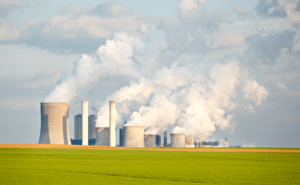
Oil and gas companies face mounting pressure to cut methane emissions by over 30% from 2020 levels by 2030 under the Global Methane Pledge. Moreover, the U.S. EPA’s New Source Performance Standards mandate frequent Leak Detection and Repair (LDAR) surveys to comply with strict emission limits. Consequently, operators must adopt innovative monitoring methods that meet regulatory deadlines and support their climate goals.
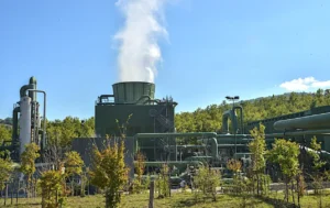
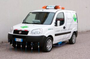
Beyond regulations, traditional on-site leak detection exposes technicians to high-pressure lines and confined spaces, increasing safety risks. In addition, ground crews can only survey limited areas each day, delaying leak detection and repair. As a result, fugitive emissions may linger undetected, undermining both safety and compliance. Thus, companies need rapid, remote solutions that deliver comprehensive coverage without risking personnel.
What Are the Limitations of Traditional Methane Leak Detection Methods in the Oil & Gas Industry?
1. Fixed CEMS vs. Mobile Surveys
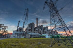
Oil and gas sites often rely on Continuous Emission Monitoring Systems (CEMS) that provide 24/7 data from stationary sources, ensuring compliance with emission standards. However, they often lack the spatial resolution needed to detect leaks in inaccessible areas, such as remote pipelines or elevated equipment. This limitation can result in undetected emissions that compromise environmental safety.
On the other hand, portable handheld analyzers require technicians to physically access various parts of a facility, often traversing hazardous terrain. Teams must walk pipelines and compressor stations, slowing down surveys and delaying critical repairs. This approach not only exposes personnel to potential dangers but also limits the area that can be surveyed in a given time frame, potentially delaying leak identification.
2.2 Cost and Logistical Constraints
Implementing fixed sensors across extensive pipeline networks is capital-intensive, requiring significant investment in equipment and infrastructure. Additionally, manual surveys conducted by ground crews are labor-intensive and time-consuming. These surveys may miss intermittent leaks that occur between inspection intervals, leading to prolonged emissions and increased risk.
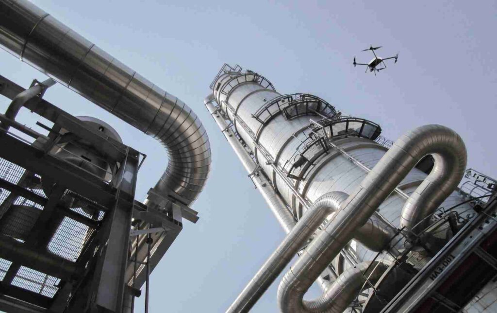
Given these challenges, the oil and gas industry is exploring innovative solutions to enhance methane leak detection. Integrating drone technology equipped with advanced sensors offers a promising alternative, combining comprehensive coverage with improved safety and efficiency.
Why Choose Drone-Based Methane Leak Detector?
(ESEGAS Drones for Methane leak detection)
Drones pair remote access, high-precision sensing, and real-time analytics to solve challenges that ground crews and fixed monitors cannot handle efficiently.
- Remote Access to Hard-to-Reach Sites
- Unmanned Aerial Vehicles (UAVs) inspect pipelines, well pads, and compressor stations without sending crews into rugged terrain or confined spaces.
- In offshore and arid regions, drones cover areas unreachable by trucks or personnel, ensuring no leak goes unchecked.
- High-Precision Sensing
- Advanced sensors like TDLAS deliver sub-ppm sensitivity, pinpointing even minor methane plumes.
- Optical Gas Imaging (OGI) cameras visualize leaks in real time, overlaying thermal signatures onto live video feeds.
- Real-Time Analytics & Reporting
- Data streams wirelessly to ground stations, enabling instant leak alerts and mapping of emission hotspots.
- Automated flight missions log geo-tagged concentration readings, generating compliance reports with minimal human input.
- Safety & Cost Efficiency
- Drones reduce personnel exposure to high-pressure equipment and toxic atmospheres, cutting field risk by over 60%.
- Compared to manual LDAR campaigns, UAV surveys save up to 50% in labor and travel costs, while covering larger areas per sortie.
- Scalability & Flexibility
- Operators can deploy fleets of drones, scaling inspections seasonally or by asset criticality.
- Modular payloads allow quick swapping between methane, VOCs, and other gas sensors, adapting to varied survey goals.
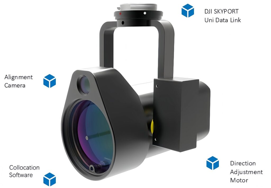
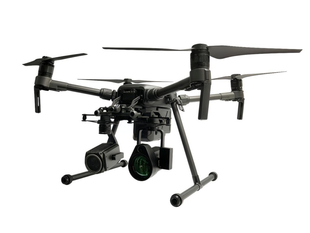
(ESEGAS U10)
Having established why drones excel in remote sensing, precision, and efficiency, the following section will explore specific drone-based sensor configurations, such as the ESEGAS U10 TDLAS detector, and outline best practices for integrating UAV LDAR into existing oil and gas workflows.
What Key Advantages Does Drone-Based Methane Leak Detector Offer in Oil & Gas?
1 Remote & Rapid Deployment
- 100 m Detection Range: The ESEGAS U10 locates leaks as small as 5 ppm·m from up to 100 m away, keeping crews out of harm’s way.
- Automated Flight Missions: Using the α-ONE app, operators pre-plan waypoints and run repeatable surveys, cutting field time by roughly 40%.
2 High Sensitivity & Accuracy
- TDLAS Technology: Tunable-diode laser absorption spectroscopy delivers sub-ppm resolution and resists interferents better than NDIR sensors.
- 25 ms Response Time: Near-instant feedback lets teams pinpoint plume sources in real time.
3 Data Integration & Compliance
- On-board Logging & Reporting: Drones automatically generate LDAR inspection reports, streamlining audit trails and regulatory filings.
- Visual Overlay: A built-in 720p camera maps methane concentrations onto site imagery, producing intuitive heatmaps for rapid decision-making.
4 Cost & Safety ROI
- Reduced Field Labor: Drone surveys cut manpower needs by up to 60% compared to manual walks and checks.
- Lower CapEx (Capital Expenditures): Lightweight payloads (the ESEGAS U10 weighs just 534 g) mount on standard DJI Matrice frames, avoiding expensive custom platforms.
By leveraging these strengths, oil and gas operators can shift from slow, risky ground surveys to fast, safe, and data-driven drone inspections—transforming methane LDAR into a more proactive and cost-effective practice.
What Key Components Do Drone-Based Methane Leak Detector in Oil & Gas?
Drone-mounted methane leak technology inspects a broad range of oil & gas infrastructure—from well pads and pipelines to storage tanks and valves. By combining optical gas imaging, TDLAS sensor, and precise flight control, UAV surveys can sweep over critical components that traditional methods often miss. Operators gain comprehensive coverage, enhanced safety, and timely data on leaks at connectors, flanges, controllers, hatches, compressors, and more.
-Drones hover around wellhead assemblies, scanning seals, tubing heads, and casing vents for fugitive CH₄ emissions.
-Drones inspect pressure relief valves and flowline connections at multiple angles, detecting leaks that ground crews might overlook.
2. Pipelines and Gathering Lines
-UAVs fly along pipeline corridors, mapping connector joints and weld seams for micro-leaks.
-Fixed-wing drones handle long-distance runs, while rotorcraft examine elbows, flanges, and valve stations in tight spaces.
3. Compressor and Pump Stations
-Drones circle compressor units, checking seals on suction and discharge lines under live pressure.
-Drones also survey pump skid frames, monitoring vent stacks and sample ports for unexpected emissions.
4. Storage Tanks and Manifolds
-UAVs scan tank roofs and breathing vents, identifying leaks around thief hatches and pressure-vacuum (PV) valves.
-Drones inspect manifold piping, gauging connections between multiple tanks for creeping emissions.
5. Valves, Regulators, and Controllers
-Remote drones capture imagery of manual and automated valves, detecting seal failures and diaphragm leaks.
-Drones hover over pneumatic controllers, measuring emissions from bleed ports that can account for substantial CH₄ losses.
6. Tank Thief Hatches and Fill Points
-UAVs approach thief hatches at safe standoff distances, using TDLAS to spot leaks as low as 1 ppm over 100 m.
-Drones check fill points during offloading operations, verifying that transfer seals maintain integrity.
7. Flare Stacks and Vents
-Drones inspect pilot light assemblies and stack seals to ensure complete combustion and minimal slip emissions.
-Drones measure vent stack efflux, highlighting inefficiencies in vapor recovery units (VRUs).
8. Gathering Compressor Controllers
Drone surveys extend to midstream controller racks, scanning gas chromatograph sample lines for micro-leaks. They log geo-tagged readings to link specific controllers with emission rates for targeted maintenance.
By routinely deploying UAVs over these components, oil & gas operators can build a detailed emission inventory and prioritize repair work. In the final section, we will discuss integration of these surveys into enterprise LDAR programs, leveraging cloud analytics and anomaly alerts.
How Can Oil & Gas Teams Effectively Implement Drone-Based Methane Leak Detector?
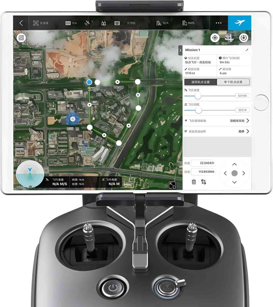
(Flight Planning & Waypoint information)
Implementing a drone-based methane leak program hinges on three pillars: choosing the right drone and sensor package, planning safe and thorough flights, and turning raw data into actionable reports. By integrating the ESEGAS U10 TDLAS detector with DJI Matrice airframes, setting up rigorous calibration routines, defining automated waypoint grids, streaming real-time CH₄ telemetry, and using cloud dashboards with anomaly alerts, teams can achieve faster, safer, and more compliant leak detection.
1 Platform Selection & Integration
- DJI Matrice 200/300 Series Compatibility:
Leverage SkyPort for direct power and gimbal mounts. This seamless integration cuts payload setup time and ensures stable flights. - Sensor Calibration Protocols:
Schedule monthly zero and span checks on the ESEGAS U10 to guarantee ±2% accuracy. Document each calibration in the α-ONE app for audit trails.
2 Flight Planning & Execution
- Automated Waypoints:
Design grid or transect patterns over pipeline corridors, storage tanks, or well pads. Use consistent flight heights to maintain sensor sensitivity. - Real-Time Telemetry:
Stream CH₄ concentration values (mg/m³) back to the controller. Adjust altitude or flight speed dynamically to chase plume signals and refine leak location.
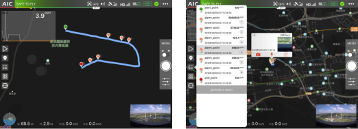
3 Data Analysis & Reporting
- Cloud Upload:
Sync every flight’s geo-tagged readings to the α-ONE centralized dashboard. This enables cross-site trend analysis and regulatory filing exports. - Anomaly Flagging:
Set customizable thresholds (e.g., >10 ppm·m) that trigger instant SMS or email alerts. Mark flagged waypoints on interactive maps for rapid repair dispatch.
By following these practical steps—pairing the lightweight ESEGAS U10 with a proven DJI drone, automating flight surveys, and leveraging cloud analytics—oil and gas teams can transform methane Leak Detection and Repair (LDAR) from a slow, manual chore into a fast, data-driven process.
Conclusion

Drone-mounted TDLAS detectors like the ESEGAS U10 unlock safer, faster, and more cost-effective methane LDAR programs. They offer up to 100m remote sensing, sub-ppm sensitivity, and real-time analytics. By automating waypoint surveys and streaming CH₄ data live, operators can detect, locate, and repair leaks in hours instead of days.
Next Steps:
- Pilot a Drone Leak Detection Survey
- Compare to Existing LDAR Results
- Scale Fleet Integration
By taking these steps, oil and gas operators can transform their LDAR programs into proactive, data-driven operations that enhance safety, streamline compliance, and advance sustainability goals.